


- Cleveland Volcano in Alaska's Aleutian Islands wakes up alongside Bogoslof volcano
- Deadly underwater volcano expected to erupt after ocean surface recently changed 400 km south of Tokyo
- Category four or five cyclone possible for north Queensland Australia: Storm is expected to be named Debbie gale-force winds from tomorrow
- New formation: Tropical Cyclone Caleb nears Southern Indian Ocean paradise Cocos Island
- 500,000 people affected, 11 dead as rains have left reservoirs overflowing in Angola after crippling drought
- Peru disaster update: 84 dead 20 missing almost 80,000 injured and 150,000 properties damaged
| Cleveland Volcano in Alaska's Aleutian Islands wakes up alongside Bogoslof volcano Posted: 24 Mar 2017 10:27 PM PDT  Bogoslof (Boh-gohs-lawf) Volcano has been erupting periodically since mid-December. On Friday, the Alaska Volcano Observatory detected a small explosion at Cleveland Volcano. Geologists say the event at 8:15 a.m. did not last long and was similar to or smaller than other explosions at Cleveland Volcano. Clouds covered the cone-shape mountain and obscured observations by satellite or boat. Geologists say any ash cloud generated probably dissipated and was not above 20,000 feet, where it could threaten airliners traveling between Asia and North America. The volcano is 940 miles (1,512 kilometers) southwest of Anchorage. Home Page The Wire  |
| Deadly underwater volcano expected to erupt after ocean surface recently changed 400 km south of Tokyo Posted: 24 Mar 2017 10:44 AM PDT 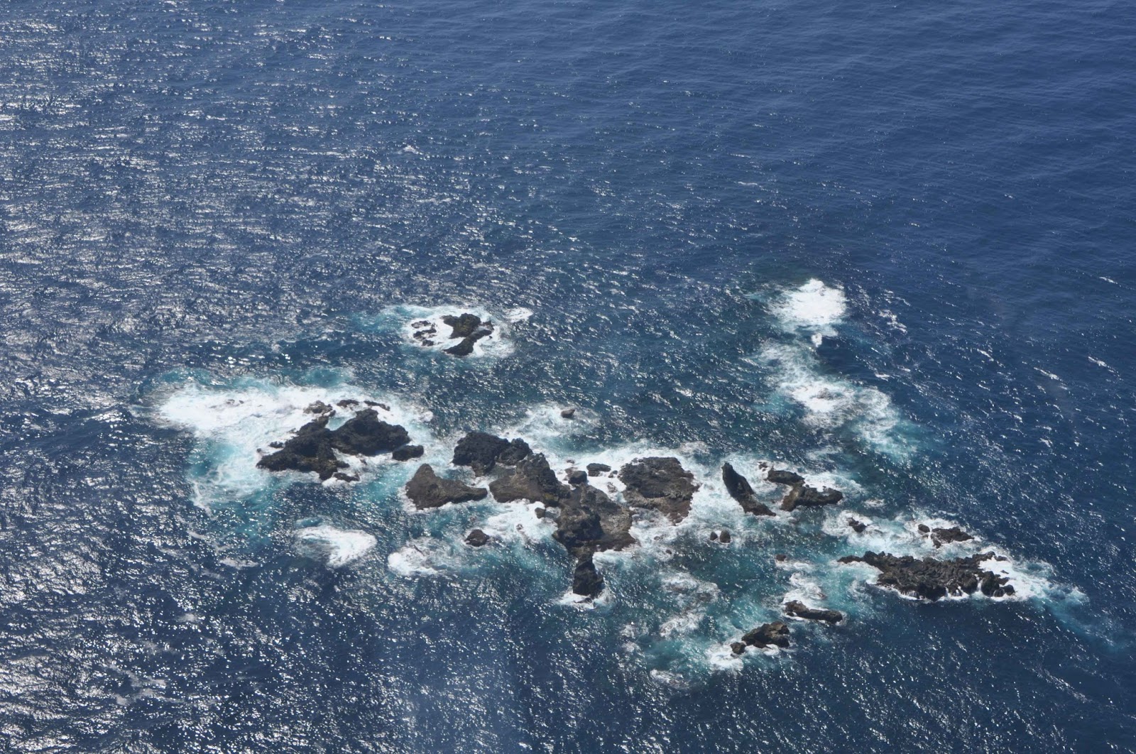 The Meteorological Agency on Friday warned that an underwater volcano about 400 km south of Tokyo could erupt soon, spurring the Japan Coast Guard to issue an alert to ships in the area. Coast guard aircraft found that the color of the ocean surface recently changed apparently due to volcanic activity in the Beyonesu Rocks about 65 km south-southeast of Aogashima Island, part of the Izu Island chain off Tokyo, the agency said. But an eruption is unlikely to seriously affect any of the inhabited islands, including Aogashima, the agency said. If the eruption occurs around the Beyonesu Rocks, it will be the first since 1970, where a change of color in the ocean was last observed in 1988, the agency said. In 1952, an eruption in the area killed 31 crew members of a coast guard ship. Home Page The Wire  |
| Category four or five cyclone possible for north Queensland Australia: Storm is expected to be named Debbie gale-force winds from tomorrow Posted: 24 Mar 2017 09:10 AM PDT  A tropical cyclone expected to reach category 5 (equivalent to a category 5 hurricane) early next week is off the north-east Queensland coast and is expected to make landfall between Cairns and Townsville on Monday according to the Bureau of Meteorology (BOM). Photo BOM Gale-force winds were expected to begin on Saturday, with a cyclone predicted to reach land on Monday morning or on Tuesday. The tropical storm is expected to be named Debbie.  There is always some uncertainty associated with tropical cyclone forecasting and the grey zone indicates the range of likely tracks of the cyclone centre. Due to the uncertainty in the future movement, the indicated winds will almost certainly extend to regions outside the rings on this map. Home Page The Wire  |
| New formation: Tropical Cyclone Caleb nears Southern Indian Ocean paradise Cocos Island Posted: 24 Mar 2017 02:36 AM PDT  On March 23 at 0700 UTC (3:00 a.m. EST) the Visible Infrared Imaging Radiometer Suite (VIIRS) instrument aboard NASA-NOAA's Suomi NPP satellite provided a visible image of Caleb. The VIIRS image showed most of the clouds and convection (rising air that condenses and forms the clouds and storms that make up a tropical cyclone) were west of the center, as a result of easterly wind flow. The Atmospheric Infrared Sounder or AIRS instrument aboard NASA's Aqua satellite looked at Tropical Cyclone Caleb in infrared light on Mar. 23 at 0729 UTC (3:29 a.m. EST). AIRS infrared temperature data showed some cloud top temperatures of thunderstorms west of Caleb's center were as cold as minus 63 degrees Fahrenheit (minus 53 degrees Celsius). NASA research has shown the storms with cloud tops that cold have the potential to generate heavy rainfall. Those storms were affecting Cocos Island at the time Aqua passed overhead. The Joint Typhoon Warning Center noted Caleb's formation at 0900 UTC (5 a.m. EST) when Caleb's maximum sustained winds were near 40 knots (46 mph/74 kph). Caleb was located near 12.4 degrees south latitude and 100.6 degrees east longitude. That's about 215 nautical miles (133.6 miles) east of Cocos Island. Caleb was moving to the southeast at 10 knots (11.5 mph/18.5 kph). The Joint Typhoon Warning Center forecast track takes Caleb southeast. It is expected to strengthen briefly, turn west and dissipate after five days. Rob Gutro NASA's Goddard Space Flight Center Home Page The Wire  |
| 500,000 people affected, 11 dead as rains have left reservoirs overflowing in Angola after crippling drought Posted: 24 Mar 2017 02:06 AM PDT 
Floods in Angola have killed at least eleven people and left thousands homeless after the country was hit by torrential rain, rescuers said yesterday. Over 700 homes were destroyed following the deluge in the coastal north-western Luanda Province which began on Tuesday afternoon and lasted into the early hours of yesterday, rescue service spokesperson Faustino Mingues told AFP. "The victims died when houses collapsed, or after being swept away by the water," he said. Others were killed after being electrocuted by high-voltage power lines that had been downed by the extreme weather. Among the dead were a two-year-old baby and a 70-year-old, according to Mingues, who added that at least 5,300 homes have been flooded. A school and a church were also demolished by the deluge which has paralysed the Angolan capital Luanda, affecting the supply of electricity and clean water and causing traffic chaos on the city's roads. Mingues warned that several reservoirs on the outskirts of Luanda were almost full and threatening to overflow. There were reports of several people still missing following flash floods, according to the state-run Angop news agency. Officials warned last week that the ground in many areas had been left saturated following heavy rains that have already affected more than 500 000 people and followed five years of drought. "With the high level of rain, we are afraid that many homes . . . are submerged because the soil is saturated and cannot absorb water," regional official Goncalves Namweya told the Lusa news agency on Friday. Farmland has also been affected and many roads are impassable - especially in rural areas - forcing people to travel on canoes supplied by emergency services, Namweya added. Astonishing turn around Angola is now the sixth country or area this year to witness an astonishing turn around for drought crippled regions around the globe: California, Zimbabwe, New Zealand and Madagascar, Namibia and now Angola have had droughts wiped out! Home Page The Wire  |
| Peru disaster update: 84 dead 20 missing almost 80,000 injured and 150,000 properties damaged Posted: 24 Mar 2017 01:35 AM PDT  Peru's Defense Minister Jorge Nieto on Thursday confirmed the number of lives lost to torrential rains, overflows and floods lashing the country has further jumped to 84. "We regret to report the passing of five more Peruvians.  Most of the Trujillo main square and nearby houses are flooded. (Photo: Johny Aurazo/ El Comercio) Yesterday, we had 79 fatalities, and today these add up to 84," Nieto told State-run TV Peru station. The government official also noted 20 people are still missing and at least 79,200 citizens have been injured. In terms of infrastructure, 12,987 properties have collapsed, 149,541 are damaged and 13,974 have become uninhabitable, the National Emergency Operations Center's (COEN) latest update revealed. On the other hand, the Defense head informed Chancay River (northern Lambayeque region) has been declared under red alert due to its rising levels. An orange alert has been issued for rivers Piura, Jequetepeque, Mala and Cañete. There is a yellow warning for Tumbes River Nieto said the rest of rivers -including Rimac River, which burst its banks flooding km 44 of Central Highway- post normal flow. In this sense, he explained Rimac River's overflow was not triggered by increased flow, but rather by accumulated humidity and erosion that caused the ground to collapse. This notwithstanding, he affirmed Lima citizens "are reassured." Home Page The Wire  |

» utube MM&C 4/26/24 Iraqi Dinar - US Treasury Exchange Rates- Focus - Banking Partnerships - Rate C
» Parliamentary efforts to transform Iraq into a global market for transferring Internet capacities
» A parliamentary committee that enriches the political forces: Stop plundering Iraq’s wealth and work
» Politician: Salem Al-Issawi is the most likely to assume the presidency of Parliament
» The price of the dollar is close to 145 thousand dinars؛ how much is $100 worth of transactions؟
» Al-Sudani: The world today is witnessing crises whose impact has been reflected in the global econo
» The Federal Court responds to an inquiry by Al-Sudani regarding the powers of the provincial council
» Among them are the Iraqis... a list of the most sought-after immigrants to America
» An expert talks about the "biggest barrier" and the positives of merging Iraqi and Arab banks
» The House of Representatives adjourns its session
» Parliamentary demands to expedite the legislation of the Eid al-Ghadir holiday law (documents)
» Parliament adds the paragraph “Electing the Speaker of the House of Representatives” to its agenda
» Alsumaria publishes the text of the law against prostitution and homosexuality
» A parliamentarian reveals the reason for the failure of the Speaker of Parliament to pass during tod
» Al-Sudani: The government has launched many strategies and initiatives that will improve the reality
» International Business: Iraq has made progress in supporting businesses through investment and priva
» Association of Banks: Iraq is witnessing great development in the transition to electronic governmen
» The House of Representatives votes to add an item to its agenda (election of the Speaker of the Hous
» Parliamentary integrity: Combating corruption requires parliamentary legislation
» Al-Karaawi: America is trying to restrict Iraq
» The State of Law coalition moves to form the local government in Diyala
» The Sudanese and his battle against corruption.. Where is the fault with the government or with the
» Prime Minister's Advisor: We will see the dollar fall on the black market soon
» The Sunni blocs are resolute. The presidency of the Council is ours, away from Al-Halbousi
» Al-Sudani discusses with a workers’ organization his government’s steps in this field
» Parliament holds its session in the presence of 170 deputies
» In the presence of Nechirvan Barzani and Al-Sudani... the State Administration Coalition holds an “i
» The UAE company ADNOC resorts to Iraqi oil. Find out the reasons
» The Iraqi Parliament votes to add an item to elect a president to its agenda
» The Federal Court responds to an inquiry by Al-Sudani regarding the powers of the provincial council
» Al-Sudani: It is necessary to attract women to work as a productive energy that cannot be disrupted
» Zebari regarding targeting the Kormor field: a systematic attack on the economy of Kurdistan
» Saudi Arabia tops, and this is Iraq's rank... a list of major suppliers of crude oil to South Korea
» With a value of 125 million dollars.. Iraq is at the forefront of countries importing Iranian textil
» More than a billion dollars in sales from the Iraqi Central Bank within a week
» Al-Sudani stresses the need for the expertise of the International Labor Organization to legislate a
» Including the return of 21 wanted persons.. The Iraq Money Recovery Fund counts its achievements in
» The path to development is the criterion between true patriotism and political clowning.
» The file of the Presidency of Parliament is on the state administration table... this evening
» Director General of the International Labor Organization: Many challenges in the world of work and t
» Al-Sudani: The world is witnessing crises that reflect negatively on the Arab and international peop
» Prime Minister: Our government has provided great support for the success of the activities, program
» Al-Asadi: Iraq places the social protection file among its priorities
» Al-Sudani: Iraq is one of the first countries in the region to join the International Labor Organiza
» In the presence of Al-Sudani and Barzani, the State Administration Coalition holds an “important” me
» Appreciating the presence of Al-Sudani... Director General of the Arab Labor Organization: Here from
» Prime Minister: Our government has provided great support for the success of the activities, program
» Al-Sudani: The world is witnessing crises that reflect negatively on the Arab and international peop
» The Parliamentary Development Institute organizes a workshop on the political role of the representa
» With Arab and international participation. Tomorrow will be the start of the Fourth Baghdad Internat
» OPEC Secretary General: The end of oil is not on the horizon
» Closing a number of unlicensed offices and companies south of Baghdad
» Repercussions of the bombing...intensive government movements to resume work in the “Kormor” field
» In the presence of Al-Sudani...the opening of the Arab Labor Conference in its 50th session in Baghd
» Al-Sudani: We are working on drawing future visions regarding the “green and digital” economic secto
» Barzani after the Kormor attack: We are ready to coordinate with Baghdad to put an end to these atta
» Al-Sudani directs the formation of an investigative committee into the circumstances of the Kormo fi
» Bismayah is confused about the new electronic portal.. What about the landlord and the subcontracts?
» Kurdistan Government: Loss of 2,500 megawatts of electricity due to targeting the Kormor field
» Crisis in Kurdistan: 12-hour daily power outage and complaints of “confusion”
» The Supreme Anti-Corruption Commission demands Nineveh for the contracts concluded by “Najm Al-Jubou
» Al-Khanjar, Al-Samarrai, and Abu Mazen are hosted by Shaalan Al-Karim to discuss accelerating the se
» Iraq asks the countries of the world to respond to its requests to extradite wanted persons: We have
» “It is coming soon.” The Sudanese advisor sets the date for the referral of the Baghdad metro and th
» Al-Mubarqa: Iraq reserves its full right to respond to the Australian behavior
» Dollar exchange rates on Iraqi stock exchanges... recorded a decline, and this is the list
» Mr. Al-Sadr supports the position of American university students
» Iraqis are ranked 7th in the Arab world on the list of those most seeking immigration to America. He
» Soon.. 3 new hospitals will open in Baghdad
» Sponsored by Al-Sudani...the opening of the Arab Labor Conference in its fiftieth session in Baghdad
» Al-Shammari chairs a meeting at the controlling headquarters to review the results of the security o
» Arab Labor Organization: We commend Iraq's interest in the Arab Labor Conference
» Al-Sudani: The development road project will provide many job opportunities
» Sudanese advisor criticizes Kuwaiti analyzes regarding the development road project
» Al-Mandalawi stresses the need to strengthen economic and trade cooperation between Iraq and Poland
» Power maneuvers: America provides defensive weapons to Kurdistan in exchange for withholding from Ba
» Kuwait is drilling an oil well near Umm Qasr, towards Iraqi territory
» In the document... the first Iraqi ministry identifies the obstacles to changing the new official wo
» Italian Institute: Iraq is stuck in its own crises, including Baghdad’s efforts to undermine the “au
» The head of the Integrity Commission announces the holding of an international Interpol conference i
» Planning: Iraqi companies are not efficient in conducting the population census
» MM&C 4/25/24 National Bank of Iraq goes live with Temenos core banking and payments
» A banking official indicates a "danger" to Iraq by depriving more than half of its banks of dollars
» With the participation of the Association of Private Banks, investment opportunities are on the tabl
» Within a month... an Iranian border crossing recorded a noticeable increase in exports of goods to I
» The Association of Private Banks appreciates the efforts of the government and the Central Bank to c
» Al-Maliki's coalition presents a third candidate for the position of governor of Diyala
» Arab gathering: The Kirkuk problem is getting complicated and the Sudanese must intervene
» Next week.. a Kurdish delegation will visit Baghdad to meet with the Minister of Finance
» Under the pretext of salaries... Al-Party refrains from handing over port revenues to Baghdad
» Association of Banks: For the first time, we are witnessing a clear targeting of depriving half of t
» Parliament does not know the reason for the delay in sending the 2024 budget schedules: Voting takes
» Applicants for the 2024 Hajj are demanding that the Central Bank secure the dollar for them through
» Governmental and private banks will showcase their services tomorrow during Financial Inclusion Week
» Iraq's oil exports rise despite OPEC+ cuts
» A study explodes a "surprise"... Iraq is among the countries that export oil to "Israel": How is the
» Al-Araji emphasizes working to strengthen national identity
» Al-Sudani visits Saudi Arabia to participate in the World Economic Forum in Riyadh